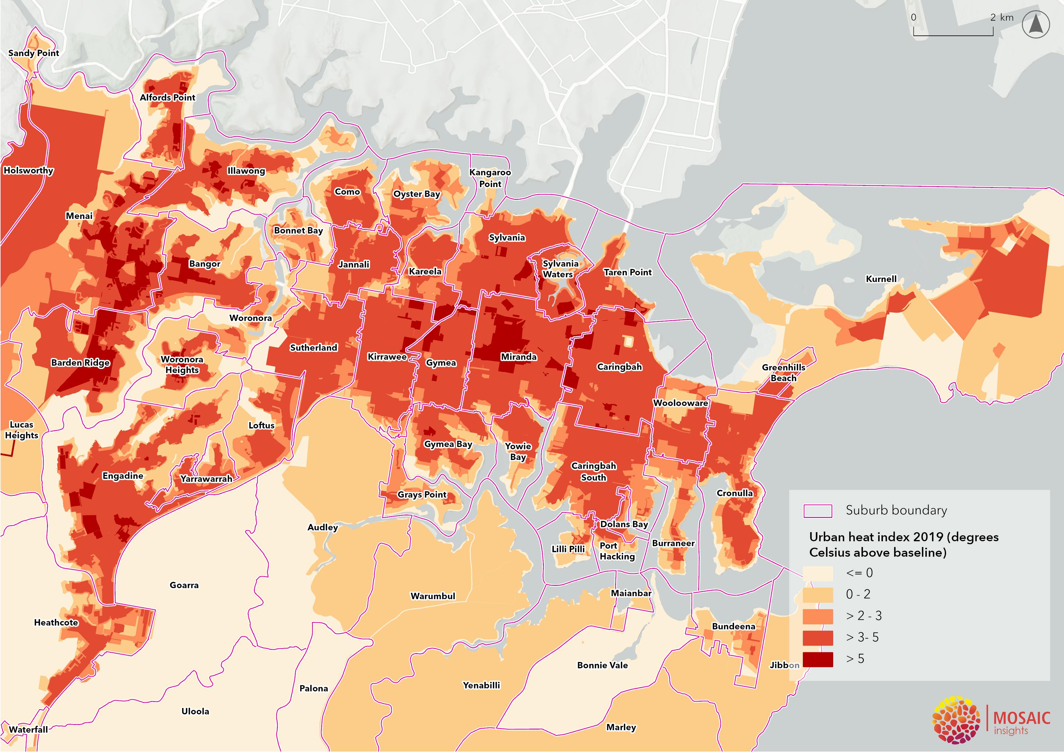
Canopy and heat maps

Tree canopy analysis for Sutherland Shire shows that the 2020 canopy cover is 43.6% when considering the LGA as a whole (including national parks) and 24.7% when considering urban areas only.
Tree canopy cover notably decreases from western suburbs to eastern suburbs.
There are pockets of very low canopy cover (less than 10%) on private land. These areas primarily consist of large business precincts in Kirrawee and Caringbah.
When considering Sutherland Shire as a whole, the road canopy coverage was at 30% in 2020, with a decline of 0.9% from 2016.
Read more on pages 10-11 of the Draft Strategy.