
Canopy and heat maps
Urban environments are generally hotter than natural and rural ones due to higher levels of building materials (which absorb and hold more heat) and lower levels of vegetation (AdaptNSW 2023).
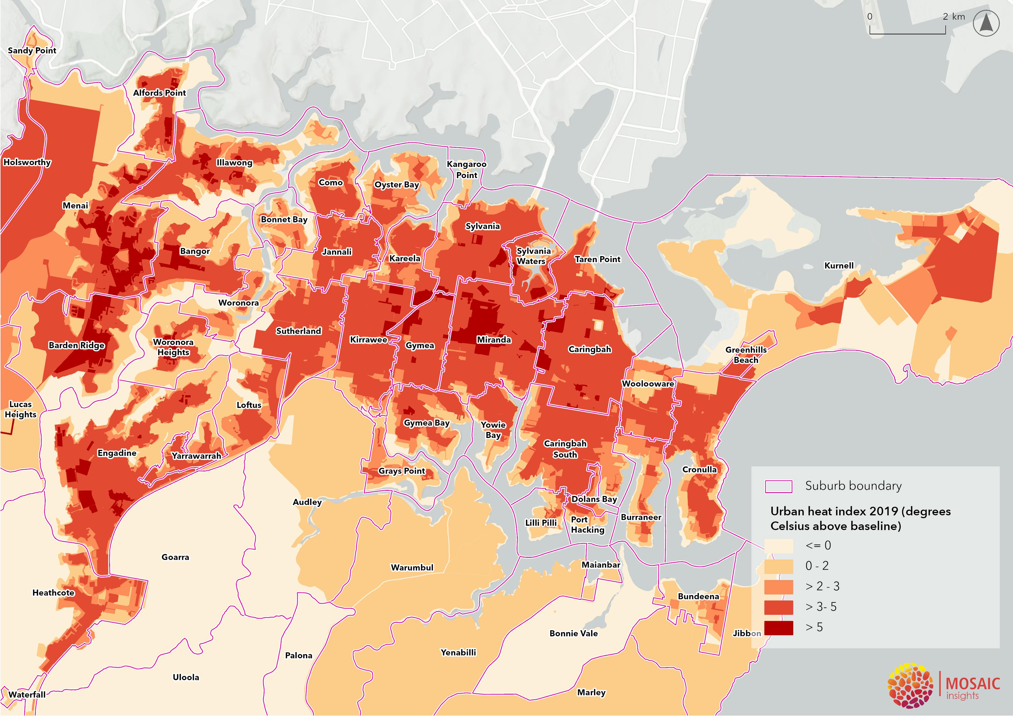
This map shows areas with higher peak summer surface temperatures, compared to a natural baseline. Urban heat is highest (greater than 7 degrees Celsius above baseline) in central Miranda and recently developed areas of Barden Ridge, Menai, Illawong, Alfords Point and Bangor NSW.
This Urban Heat Index (NSW Department of Planning and Environment) contains data from 2019 and is not reflective of current community vulnerability to excess heat in new growth suburbs.
