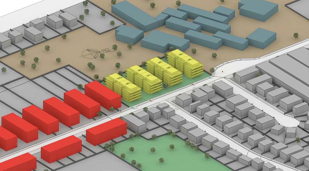
The purpose of this amendment is to rezone land at 87-97 Willarong Road, Caringbah from R2 Low Density Residential to R4 High Density Residential which will permit residential flat buildings to be developed. The amendment also includes an increase in the maximum Floor Space Ratio from 0.55:1 to 1.2:1 and maximum height from 8.5m to 16m. The proposal also decreases the landscaped area required to 30% and removes minimum lot size in line with the development standards for the proposed zone.
Please use the Document Library (at right) to review the Planning Proposal, Council Reports and other information. More information is provided through the FAQ section (above at right).
Council has prepared a Planning Proposal Mapping Tool to show all Draft Planning Proposals which have received a Gateway Determination. As this amendment has now been gazetted, it will be removed from the Planning Proposal Mapping Tool shortly.
A link to NSW Planning and Environment's Planning Proposal Tracking Website is provided above at right.
The making of this plan has been delegated to Council by the Minister for Planning.
Life Cycle
Open
LEP 2015 Amendment 5 - 87-97 Willarong Road, Caringbah rezoning has finished this stage
This consultation has now been extended until the 29th of August, 2016.
Under Review
LEP 2015 Amendment 5 - 87-97 Willarong Road, Caringbah rezoning has finished this stage
Contributions to this consultation are closed for evaluation and review. The Project team will report back on key outcomes.
Final report
LEP 2015 Amendment 5 - 87-97 Willarong Road, Caringbah rezoning has finished this stage
The final outcomes of the consultation are documented here. This may include a summary of all contributions collected as well as recommendations for future action.
Adopted
LEP 2015 Amendment 5 - 87-97 Willarong Road, Caringbah rezoning has finished this stage
Council has resolved to adopt the proposed plan. Work is underway to prepare the amendment for implementation.
Implemented
LEP 2015 Amendment 5 - 87-97 Willarong Road, Caringbah rezoning is currently at this stage
Council has made the proposed plan under delegation. The plan is now gazetted as LEP Amendment 7.